Language
Earth
The blue planet

Exploration

  1. Explorers like Columbus, Magellan, and da Gama dramatically reshaped our geographic understanding, mapping continents, oceans, and cultures previously unknown to Europeans.

  2. Geology and geography matured as scientific disciplines. Scientists like Humboldt and Lyell studied rocks, climates, and landforms, laying the foundation for modern Earth sciences.

  3. With tools like barometers and thermometers, weather patterns were recorded systematically. By the 19th century, international meteorological services and climate tracking emerged.

  4. A V-2 rocket captured the first image of Earth from space, showing our planet from over 100 km above (1946). It marked the beginning of space-based Earth observation.

  5. Launched by NASA, TIROS-1 began real-time weather observation from orbit (1960). It revolutionized meteorology and disaster forecasting.

  6. Landsat (since 1972) satellites provided continuous, detailed imagery of Earth`s surface — forests, cities, agriculture, and ecosystem changes — forming the longest Earth observation record.

  7. These missions track climate, water, pollution, and disasters in real time. ESA`s Copernicus and NASA`s EOS are leading programs for environmental monitoring.

The first person to see Earth from space was Yuri Gagarin, who orbited the planet on April 12, 1961 aboard the Soviet spacecraft Vostok-1.

Landscape

Surface

  1. Mount Everest, located in the Himalayas between Nepal and China, is the highest point on Earth's surface. It rises approximately 8,848 meters and continues to grow slightly each year due to tectonic plate movement.

  2. About 71% of Earth's surface is covered by water, with the majority found in oceans. The remaining 29% is land, consisting of continents, islands, mountains, plains, and other natural landforms.

  3. Deserts like the Sahara or Atacama form in areas with extremely low precipitation. These regions often have extreme temperatures and limited vegetation, making life possible only for highly adapted plants and animals.

  4. The surface of the Earth is shaped by the movement of tectonic plates. When plates collide, they can form mountains; when they pull apart, valleys or rifts may form, and their motion can also trigger earthquakes.

  5. Volcanoes form mostly along tectonic boundaries or above hot mantle plumes. When magma escapes through the crust, it forms volcanic cones and landscapes, often altering ecosystems and creating new land.

  6. Over time, erosion caused by wind, rain, rivers, glaciers, and waves reshapes the Earth's surface. It wears down mountains, deepens valleys, and creates features like canyons, cliffs, and coastal landforms.

Interior

  1. Earth is divided into three major internal layers: the crust, the mantle, and the core. These layers differ in composition, temperature, and physical state, and they all influence Earth's geological activity.

  2. The Earth's crust is the outermost solid layer and varies in thickness. Oceanic crust is thinner and denser, while continental crust is thicker and less dense, forming continents and large landmasses.

  3. The mantle lies beneath the crust and makes up most of Earth’s volume. It is composed of semi-solid rock and slowly moves due to heat, causing the movement of tectonic plates above.

  4. Heat from Earth's interior creates convection currents in the mantle. These slow, circular flows push tectonic plates around, leading to mountain building, earthquakes, and volcanic eruptions.

  5. The outer core is a hot, liquid layer composed mainly of molten iron and nickel. The constant movement of this liquid metal generates Earth’s protective magnetic field.

  6. The inner core, despite reaching temperatures similar to the surface of the Sun, remains solid due to the immense pressure from the overlying layers of Earth.

  7. Earth's magnetic field extends into space and acts like a shield. It deflects charged particles from the Sun, helping to protect the atmosphere and living organisms from harmful radiation.

  8. Seismic waves, produced by earthquakes, travel through the Earth’s interior. By studying their speed and direction, scientists can determine the composition and state of internal layers.

  9. Temperature and pressure increase with depth. For every kilometer you go below Earth’s surface, the temperature rises by about 25–30°C, reaching over 5,000°C in the core.

Paramaters

Equatorial diameter
12,742 km
About

The Earth’s equatorial diameter is approximately 12,756 km. This value was first calculated with surprising accuracy by Eratosthenes around 240 BCE, using simple geometric principles based on the angle of the sun’s rays at different cities. Modern satellite missions like LAGEOS and GPS networks have confirmed this measurement with high precision. The diameter is larger at the equator than at the poles because of Earth’s rotation, which causes a slight bulging outward at the equator, forming an oblate spheroid.

Polar diameter
12,714 km
About

Earth’s polar diameter is about 12,714 km, slightly shorter than the equatorial one. This flattening at the poles was predicted by Isaac Newton in the 17th century and later confirmed by French expeditions to Lapland and Peru in the 18th century. The difference in diameters results from centrifugal force due to Earth’s rotation. The shape — an oblate spheroid — was further confirmed using satellite laser ranging and Earth observation missions.

Mean radius
6,371 km
About

The mean radius of Earth is approximately 6,371 km. It is calculated as an average between the equatorial and polar radii and is used in global models such as WGS-84, essential for GPS navigation. Although Earth is not a perfect sphere, this average radius is sufficient for many scientific and engineering purposes. The value has been refined over centuries — from early meridian arc measurements to modern satellite data — achieving sub-meter precision today.

Equator circumference
40,075 km
About

Earth’s equatorial circumference is approximately 40,075 kilometers. This value was first estimated by ancient scholars, including Eratosthenes, using simple observations and trigonometry. He used the distance between two cities and the angle of the Sun’s rays to approximate Earth’s full circumference. Today, satellite technology and GPS systems allow us to measure this distance with remarkable precision. Because Earth bulges slightly at the equator, this circumference is longer than the meridional (pole-to-pole) one.

Surface area
510.1×
10⁶
km²
About

The total surface area of Earth is about 510 million square kilometers. Roughly 71% of this area is covered by oceans, while the remaining 29% is land. Early estimates came from basic geometric models, but today’s figures come from satellite altimetry, global mapping, and geodetic data. Accurate surface area is essential in climate studies, satellite design, and understanding energy balance across the planet.

Mass
5.972×
10²⁴
kg
About

Earth’s mass is estimated at around 5.972 × 10²⁴ kilograms. It was first approximated by Henry Cavendish in 1798 using a torsion balance, in what became known as the "weighing of the Earth." His experiment calculated the gravitational constant, which allowed scientists to determine Earth’s mass. Today, refined versions of that method, along with satellite motion data, provide extremely precise measurements.

Density
5.51 g/cm³
About

The average density of Earth is about 5.51 grams per cubic centimeter, making it the densest planet in our solar system. This high density results from the heavy materials in Earth’s core, such as iron and nickel. Early scientists used Earth’s mass and volume to estimate its density, but seismic studies and gravitational modeling now provide detailed insights into internal layers and their composition.

Gravity
9.807 m/s²
About

Earth’s surface gravity averages about 9.807 m/s². It was first measured accurately in the 17th century using pendulums, but its true value varies slightly by location. Gravity is stronger near the poles and weaker at the equator due to Earth’s rotation and equatorial bulge. Modern gravimeters, satellites like GRACE, and laser ranging allow precise gravity mapping, revealing ocean currents, underground structures, and even changes in ice mass.

Duration of day (stellar)
23 h 56 m 4 s
About

A sidereal day — the time it takes Earth to complete one full rotation relative to the stars — lasts about 23 hours, 56 minutes, and 4 seconds. This differs slightly from the solar day (24 hours) due to Earth’s orbit around the Sun. Ancient astronomers first noticed this difference when tracking star positions. Sidereal time is essential in astronomy and satellite navigation.

Orbital period (year)
365,25 days
About

Earth takes about 365.25 days to complete one orbit around the Sun. This extra quarter of a day is why leap years exist every four years. The precise measurement of Earth's year was refined over centuries using solar calendars, astronomical observations, and now atomic clocks. Earth's orbit is slightly elliptical, affecting seasonal variations and solar energy distribution.

Rotation speed at the equator
1674 km/h
About

At the equator, Earth’s surface rotates at a speed of about 1,670 kilometers per hour. This high speed decreases toward the poles. This rotation was inferred from observations like Foucault’s pendulum and eventually measured using satellites and laser gyroscopes. Rotation affects weather patterns, ocean currents, and flight dynamics due to the Coriolis effect.

Orbital velocity
29,78 km/s
About

Earth orbits the Sun at an average speed of about 29.78 kilometers per second (over 107,000 km/h). This velocity balances gravitational pull and centrifugal force, keeping Earth in a stable orbit. It was first calculated through Kepler’s laws and Newtonian mechanics. Today, it’s confirmed via space missions, Doppler tracking, and precise satellite positioning.

Axis tilt
23.44°
About

Earth’s axis is tilted at about 23.44 degrees relative to its orbital plane. This tilt causes the changing seasons and varying day lengths. The tilt has been measured since ancient times using sundials and star charts and is now tracked by satellites. It changes slightly over thousands of years in a cycle called axial precession, influencing long-term climate patterns.

Satellites

Moon
1609 explored
About

The Moon, Earth’s only natural satellite, formed ~4.5 billion years ago, likely from debris after a Mars-sized body's impact. Observations of lunar phases and eclipses began with ancient civilizations. Telescopes like Galileo’s in 1609 revealed craters and mountains. Samples from Apollo missions (1969–1972) confirmed its volcanic origin and provided precise age, revolutionizing our understanding of planetary formation and the Earth-Moon system.

Sputnik-1
1957 launched
About

Sputnik‑1, the first artificial satellite, launched by the USSR on 4 October 1957. This 83.6 kg polished metal sphere transmitted radio beeps on 20 and 40 MHz, orbiting Earth every 96 minutes. It operated for 22 days before reentering on 4 January 1958. Designed by Sergey Korolyov, it sparked the Space Race, shocking the U.S. and demonstrating feasibility of orbital physics and atmospheric drag measurement via its orbital decay.

Explorer-1
1958 launched
About

Explorer‑1, the first U.S. satellite, launched on 1 February 1958 atop a Juno I rocket. Weighing ~14 kg, it carried instruments that discovered Earth’s first radiation belts (Van Allen belts). It remained operational for 111 days and in orbit until 1970. Its successful mission restored U.S. confidence after Sputnik, advancing space science and marking America’s official entry into the Space Race.

Luna-1
1959 launched
About

Luna‑1, launched by the USSR on January 2, 1959, became the first spacecraft to reach escape velocity and the first artificial object to enter heliocentric orbit. It passed within 5,995 km of the Moon but missed impact. Leading figure Sergei Korolev designed the E-1 series for lunar exploration. Despite not landing, its mission paved the way for Luna‑2’s impact and Luna‑3’s first far-side photographs, marking the beginning of interplanetary Soviet missions.

Transit-1B
1960 launched
About

Transit‑1B, part of the U.S. Navy’s Transit system (precursor to GPS), launched on April 13, 1960 aboard a Thor-Ablestar rocket. It carried a navigation payload to test Doppler principle–based maritime positioning. Over 30 years, the system provided navigation for submarines, ships, and aircraft. Transit‑1B validated satellite-based positioning accuracy and reliability, laying groundwork for modern satellite navigation decades before GPS became operational.

Telstar-1
1962 launched
About

Telstar‑1, launched July 10, 1962 by AT&T/NASA on a Thor-Delta rocket, was the first active communications satellite. Equipped with a helical antenna and transponders, it achieved the first live transatlantic television broadcast on July 23, 1962. Despite operating only a few months before the Starfish Prime nuclear test damaged it, Telstar‑1 demonstrated feasibility of satellite communication and ushered in the age of global TV, telephone, and data relays.

Meteor-1
1969 launched
About

Meteor‑1, the Soviet Union’s first operational meteorological satellite, launched on March 26, 1969 atop a Vostok rocket from Plesetsk. Made by VNIIEM, it featured a three-axis stabilization system and instruments for cloud-cover imaging. It sent daily photos used in weather forecasting and environmental monitoring. Its success led to a long-running Meteor program—Meteor-1 to Meteor-3 and beyond—providing critical data on global weather, ice cover, and atmospheric dynamics.

GPS Navstar-1
1978 launched
About

Navstar‑1, launched February 22, 1978 by the U.S. Air Force, was the first Block I GPS satellite. As a prototype with onboard atomic clock technology, it tested principles of passive ranging and precise timing critical for satellite navigation. It demonstrated 3D positioning—latitude, longitude, altitude. The Block I series paved the way for operational GPS constellation, now globally used across aviation, marine, military, and civilian systems, with 24+ satellites in mid-Earth orbit.

Hubble Space Telescope
1990 launched
About

The Hubble Space Telescope launched aboard Space Shuttle Discovery on 24 April 1990 and deployed in low-Earth orbit (~547 km altitude). Named after astronomer Edwin Hubble, it carried a 2.4 m mirror. Early optical flaws delayed high-resolution imaging until the 1993 servicing mission corrected the mirror. Hubble has since revolutionized astrophysics with data on galaxy formation, exoplanets, dark energy, and cosmic expansion and continues operating with periodic updates.

International Space Station
1998 launched
About

The International Space Station (ISS), a joint project of five space agencies (NASA, Roscosmos, ESA, JAXA, CSA), began assembly in 1998 with modules Zarya and Unity. Continuously inhabited since November 2000, it orbits Earth every 90 minutes at ~400 km altitude. It supports multinational crews conducting research in microgravity, biology, materials, and space systems. With contributions from 15 countries and involvement of over 240 astronauts, the ISS is a flagship of international cooperation and space exploration.

Sentinel-1A
2014 lauched
About

Sentinel‑1A, launched April 3, 2014, is the first synthetic-aperture radar satellite in the EU Copernicus program. Orbiting at ~700 km altitude, its C-band radar can image Earth day and night, in all weather, mapping land deformation, sea ice, oil spills, and land-use changes. It captured its first radar image within nine days, providing critical data for environmental monitoring, disaster response, and scientific research. Sentinels continue to form an operational constellation.

Starlink
2019 lauched
About

Starlink, developed by SpaceX since 2015 and operational from May 2019, is the world’s largest low-Earth orbit (LEO) internet constellation. Designed to provide global broadband access, it began with two test satellites in 2018 and expanded to 1,000s of satellites by 2025. Named after John Green’s Fault in Our Stars, Starlink enables internet in remote regions, supporting over 5 million users worldwide. It’s fundamental to rebuilding global connectivity infrastructure and continues evolving with new iterations and services.

Habitability

In the Air

Earth is the only known planet in the universe that supports a vast and diverse array of life. Its unique combination of environmental factors—such as a temperate climate, the presence of liquid water, a protective atmosphere, and a stable orbit—make it an exceptional haven for life.
Among Earth's most remarkable features is its incredible biodiversity. Life here exists in nearly every corner of the planet, from the deepest parts of the ocean to the highest mountain peaks. Earth's ecosystems support an estimated 8.7 million species, including microorganisms, plants, animals, fungi, and more. Two of the most visible and widely studied groups of animals are birds and mammals.
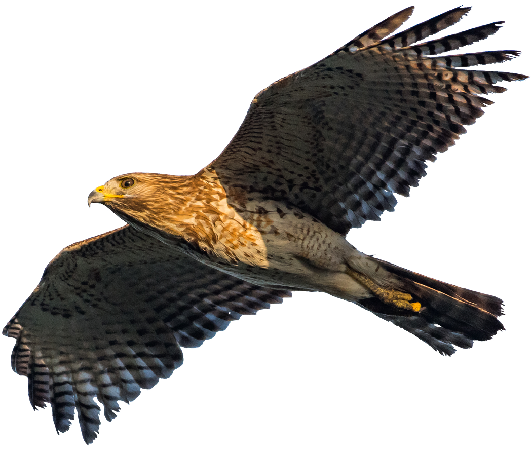
Birds inhabit virtually every ecosystem on the planet—from Arctic tundras to tropical rainforests. With over 10,000 known species, birds have adapted to a wide range of environments. Their ability to fly allows for migration across vast distances, contributing to the balance of ecosystems through pollination, seed dispersal, and insect control. Some, like the Arctic tern, migrate from pole to pole, while others, such as parrots and toucans, are found only in specific regions rich in biodiversity.
Mammals, comprising more than 6,400 species, range in size from tiny bats and rodents to massive whales and elephants. Many mammals exhibit complex behaviors and social structures. Humans, as one of Earth's dominant species, have shaped ecosystems and environments across the globe, while other mammals, like primates, big cats, bears, and marine mammals, continue to play vital ecological roles.
These animal groups—along with reptiles, amphibians, fish, insects, and countless invertebrates—form interconnected food webs that sustain life on Earth. Each species, no matter how small, contributes to the planet`s delicate ecological balance.
The abundance of oxygen, moderate temperatures, and availability of water support respiration, reproduction, and survival across all life forms. Forests, wetlands, grasslands, and oceans each harbor unique combinations of species, forming rich habitats that are vital to Earth's overall habitability.
While life is incredibly resilient, it also relies on the continued stability of Earth's climate and ecosystems. The ongoing loss of biodiversity due to habitat destruction, pollution, and climate change reminds us of the fragility of this rare planetary oasis.

hawk

The hawk is a bird of prey of the hawk family of the hawk family. It is found on almost all continents. The places where the hawk lives are different: mountains, plains, sparse forests, jungles, savannahs. The first species appeared 50 million years ago.

  1. Birds evolved from small theropod dinosaurs about 150 million years ago during the Jurassic period. Over time, they developed feathers not just for insulation but also for flight, along with hollow bones and efficient lungs. These features allowed for the active, powered flight we observe in modern birds.

  2. Bats are the only mammals capable of true, sustained flight. Their wings are formed by a thin membrane stretched over elongated fingers. They use echolocation—emitting sounds and interpreting echoes—to navigate in darkness and locate prey. This makes them unique among flying vertebrates and highly adapted to nocturnal environments.

  3. Insects such as bees, butterflies, and dragonflies rely heavily on air movement for survival. They use flight not only for foraging and pollination but also for escaping predators and migrating over long distances. Their complex eyes and chemical receptors help them navigate efficiently through their aerial environment.

  4. Some birds, especially swifts, have remarkable adaptations that allow them to spend nearly their entire lives in the air. Swifts can feed on airborne insects, sleep in short bursts while gliding, and even mate in flight. This aerial lifestyle requires precise wing control and incredible energy efficiency.

  5. Aerobic microbes have been discovered floating in Earth’s upper atmosphere, including bacteria and fungal spores. These organisms may remain viable for long periods and play roles in cloud formation and climate dynamics. Their existence suggests that life can adapt even to extreme airborne environments.

  6. Flying animals use a wide range of wing shapes and flight mechanics to suit their habitats. Hummingbirds hover with rapid wingbeats, eagles glide on thermals, and insects like flies perform agile maneuvers. These strategies optimize energy use and mobility across forests, mountains, and open skies.

On the Ground

Life on Earth’s surface represents one of the most dynamic and visible expressions of biological complexity. Terrestrial habitats—ranging from deserts and grasslands to forests and mountains—host an astonishing variety of life forms that have adapted to differing temperatures, altitudes, and moisture levels. Unlike aquatic life, surface-dwelling organisms face unique challenges such as gravity, desiccation, and greater temperature fluctuations. To survive, plants evolved structures like roots and vascular tissues for water transport, while animals developed lungs, limbs, and protective outer coverings.
Insects, the most diverse group of surface life, perform essential functions like pollination and decomposition. Larger animals, such as ungulates and carnivores, shape plant communities and maintain ecological balance through grazing and predation. Soil organisms—including fungi, bacteria, and invertebrates—form a hidden but vital layer beneath the surface, recycling nutrients and supporting plant life above.
Wild mammals—from deer and boars to wolves, foxes, and bears—remain key players in maintaining ecological balance by regulating populations and vegetation spread. Their presence or absence can reshape entire food chains. Despite their vulnerability to change, Earth's surface biosphere shows resilience and adaptability, preserving conditions that support a wide array of animal and plant species.

  1. The first land animals were arthropods, like millipedes and scorpions, which emerged over 400 million years ago from aquatic ancestors.

  2. Amphibians marked a major evolutionary step by bridging aquatic and terrestrial life, evolving lungs and legs around 370 million years ago.

  3. Reptiles evolved tough, scaly skin and laid amniotic eggs, enabling full-time life on land without returning to water for reproduction.

  4. Mammals appeared around 200 million years ago, adapting to diverse terrestrial environments with warm-blooded metabolism and complex brains.

  5. Insects became the most diverse land animals, evolving wings and metamorphosis, which helped them occupy nearly every terrestrial habitat on Earth.

deer

The deer is a hoofed mammal of the deer family. It is found in forests, meadows, and mountains across Europe, Asia, and the Americas. Deer inhabit various environments, from dense forests to open plains. The first known species of deer appeared around 20 million years ago.